Description
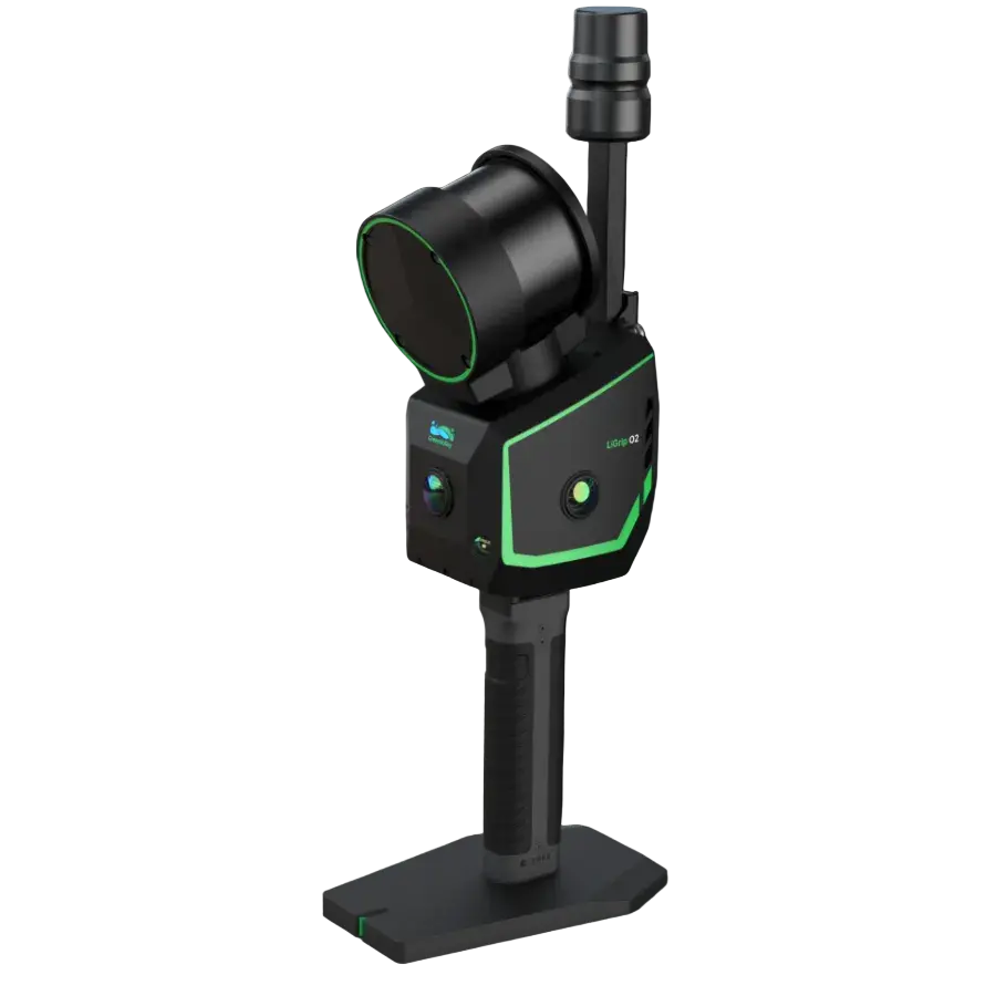
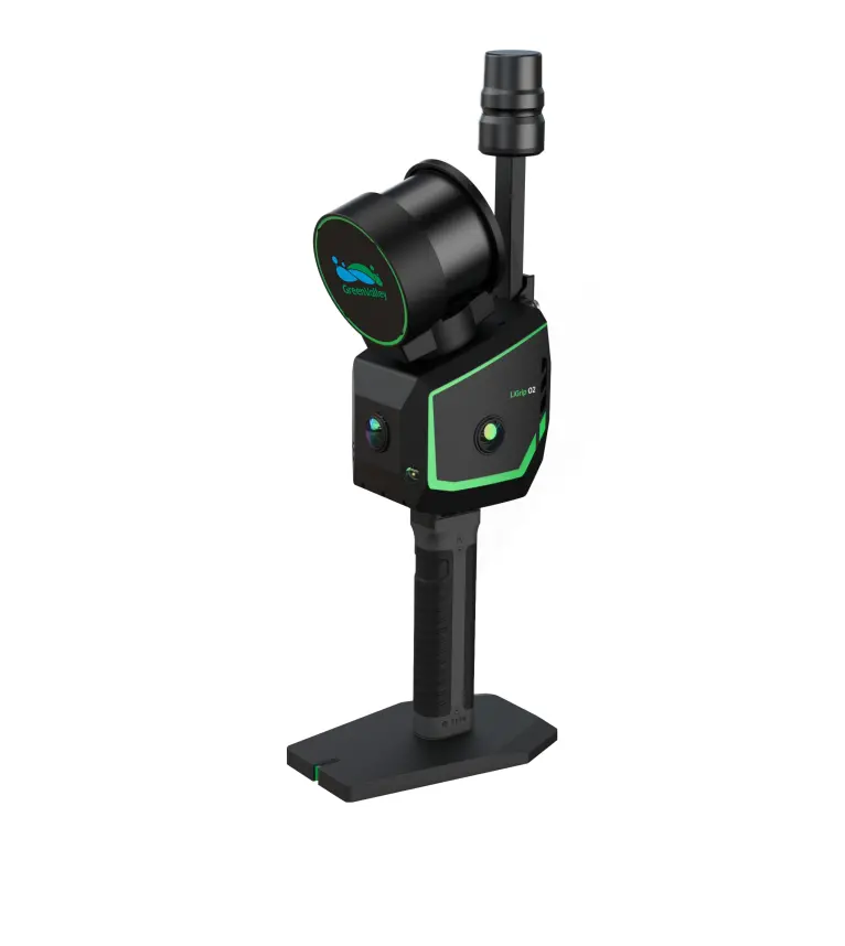
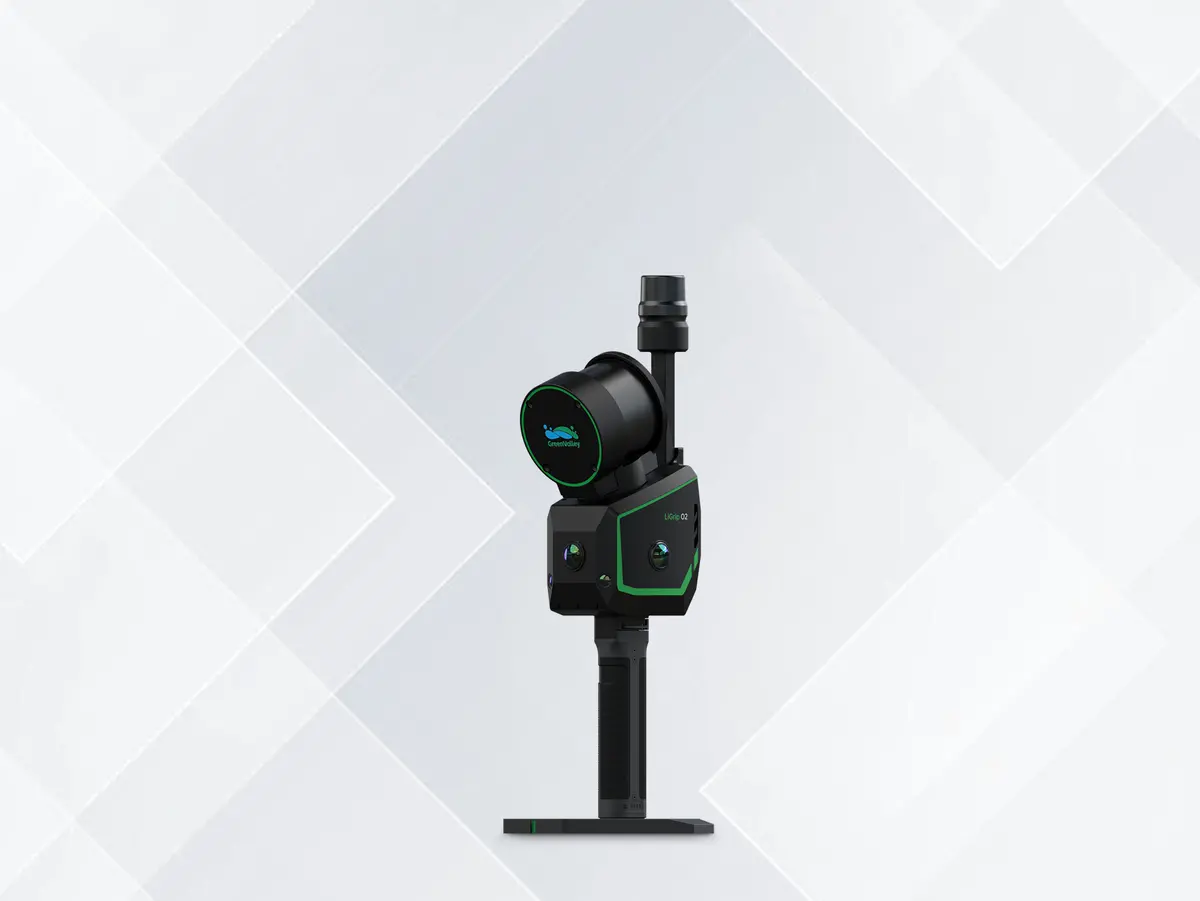
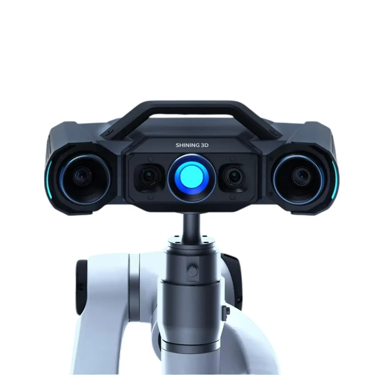
LiGrip O2
Flagship Handheld SLAM LiDAR Scanner
LiGrip O2 is the next-generation flagship handheld SLAM LiDAR scanner developed by GreenValley International. This all-in-one device integrates a laser scanner, three panoramic cameras, dual visual SLAM cameras, and a GNSS antenna, enabling high-precision, all-directional data acquisition without constraints of time or environment.
- Weight: 2.2 kg
- Absolute Accuracy: < 3 cm
- LiDAR Scan Rate: Up to 640,000 pts/s
- Max Detection Range: 300 m
- Panoramic Camera:12 MP ×3
- VSLAM Camera: 1.3 MP ×2
- FOV: 280° × 360°
- Storage Capacity: 512 GB SSD
Designed for open and featureless environments, MLF-SLAM combines multiple localization sources to achieve absolute positioning with centimeter-level accuracy. Whether on highways, beaches, or bridges where GNSS is weak or unavailable, MLF-SLAM ensures stable trajectories, consistent point clouds, and reliable mapping results.
RTK – SLAM vs MLF – SLAM

Triple-Camera Coverage for Easier and Better Capture
Front, left, and right panoramic cameras offer full 3D coverage, simplifying data capture and enhancing coloring and 3DGS quality.
Dual-Camera VSLAM for Wider and More Stable Mapping
Dual 1.3MP cameras cover the full LiDAR range, improving stability in
low-feature areas like tunnels and underground spaces.
Survey-Grade Accuracy
Powered by GVI’s self-developed multi-sensor fusion SLAM technology, the system ensures 3 cm absolute accuracy and 2 cm repeatability—regardless of operator, environment, path, or time.
Millimeter-Level Point Clouds, High-Fidelity Reality Capture
Supports point cloud outputs with 2 mm spacing, delivering results
comparable to terrestrial laser scanning.
Multiple Positioning Modes for Versatile Applications
LiGrip O2 supports various positioning modes to suit different working environments:
RTK-SLAM: Ideal for areas with RTK signal
PPK-SLAM: Suitable for environments without RTK signal
MLF-SLAM: Designed for low- or no-feature environments
SLAM: Best for GNSS-denied environments
Downloads
- Brochure
- User Guide
- Sample Data
Kit Includes:
- LiGrip O2 device (16/120, 32/120, or 32/300)
- Hard Carry Case
- Transfer Cable
- On-device Phone Mount
- Small GNSS antenna module
- High-Gain RTK Antenna (Disk Type)
- Frontpack Kit
- Extra Battery
- LiDAR360MLS BP Module Perpetual Subscription (1x perpetual software license)
- This is enough to process the data from the proprietary format outputted by the device to generic pointcloud file formats, such as .las and .ply.
- Additional modules available. Please contact Laserman if you would like more information.
Warranty Terms & Extended Service Plans:
1. Standard Warranty:
- All hardware includes a 13-month standard warranty, starting from the shipping date.
2. Extended Service Plans – Basic & Premium:
LiAir, LiBackpack, LiGrip (excl. O1 Lite/O2 Lite), LiPod and LiMobile:
- +1 year Basic: 15% of price (+1,000 USD additional for Premium)
- +2 years Basic: 30% of price (+2,000 USD additional for Premium)
LiGrip O1 Lite/O2 Lite:
- +1 year Basic: 15% of price (+600 USD additional for Premium)
- +2 years Basic: 30% of price (+1,200 USD additional for Premium)
LiBase:
- +1 year Basic: 15% of price (+600 USD additional for Premium)
- +2 years Basic: 30% of price (+900 USD additional for Premium)
Explore more from our collection.
Reviews
There are no reviews yet.