Description
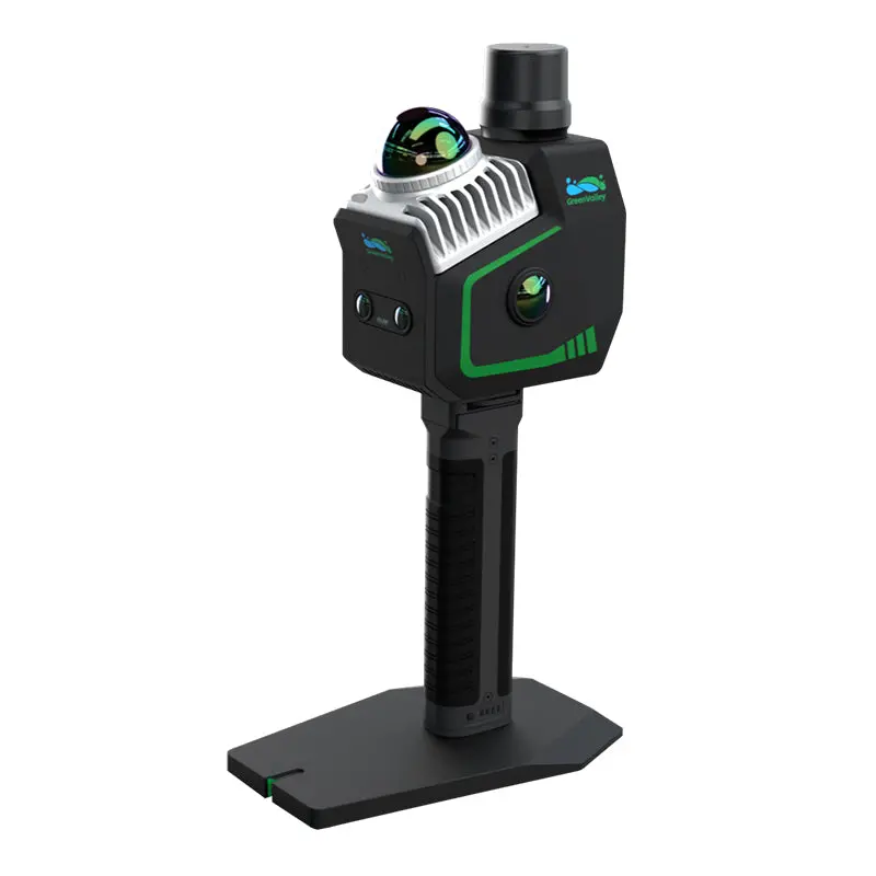
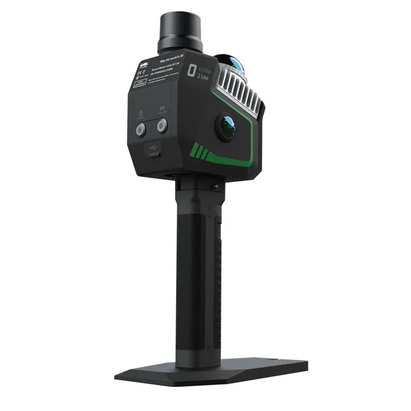
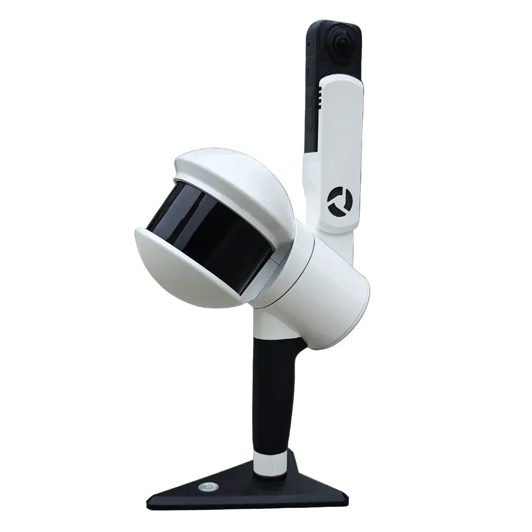
LiGrip O2 Lite
LiGrip O2 Lite is the latest-generation handheld SLAM product from GreenValley International (GVI), utilizing MLF-SLAM (Multiple Localization Fusion-SLAM) multi-sensor fusion positioning technology. It overcomes mapping challenges in featureless environments such as airports, beaches, and rivers, achieving centimeter-level data collection in all scenarios.
Featureless Data Acquisition: The innovative MLF-SLAM algorithm! A breakthrough LiDAR SLAM algorithm that overcomes mapping challenges in weak or featureless environments (e.g., airports, beaches, water areas) , enabling high-precision data acquisition across all scenarios.
Precision Data, Outstanding Performance: Compact and Mighty! 3 cm absolute accuracy, high-fidelity point cloud with precise horizontal and vertical alignment, meeting surveying-grade standards and streamlining surveying tasks.
High-definition Panoramic + Visual SLAM Camera: Dual 12 MP panoramic cameras: Microsecond-level synchronization to realistically restore scenes. Visual SLAM (VSLAM) & LiDAR-SLAM Deep Fusion enabling precise mapping in complex environments.
Real-time Processing and Colorisation: Real-time true-color point cloud mapping: Ready for immediate export, supports multi-scenario applications such as earthwork calculation, individual tree segmentation, and topographic mapping.
One-time Data Collection, Multi-dimensional Output: Integrated solution for multi-source data collection. Simultaneous output of 3D point clouds, panoramic images, 3DGS, MESH, and other data in one collection, breaking the limitations of traditional sequential operations and improving cost-efficiency.
Multi-form Data Collection: Supports various forms of data collection: Handheld, backpack, frontpack kit, and telescopic pole, allowing flexible adaptation to diverse customer collection scenarios.
RTK-SLAM Collection Mode: Self-developed RTK-SLAM technology: In conjunction with a telescopic pole, enables full-range high-precision RTK data collection, with accuracy <5 cm in 1 minute without GNSS.
- Download Brochure
- Download Software User Manual
- Download LiGrip FAQ
Kit Includes:
- LiGrip O2 Lite (with GNSS Module)
- Hard Carry Case
- Transfer Cable
- On-device Phone Mount
- LiDAR360MLS BP Module Perpetual Subscription (1x perpetual software license)
- This is enough to process the data from the proprietary format outputted by the device to generic pointcloud file formats, such as .las and .ply.
- Additional modules available. Please contact Laserman if you would like more information.
Warranty Terms & Extended Service Plans:
1. Standard Warranty:
- All hardware includes a 13-month standard warranty, starting from the shipping date.
2. Extended Service Plans – Basic & Premium:
LiAir, LiBackpack, LiGrip (excl. O1 Lite/O2 Lite), LiPod and LiMobile:
- +1 year Basic: 15% of price (+1,000 USD additional for Premium)
- +2 years Basic: 30% of price (+2,000 USD additional for Premium)
LiGrip O1 Lite/O2 Lite:
- +1 year Basic: 15% of price (+600 USD additional for Premium)
- +2 years Basic: 30% of price (+1,200 USD additional for Premium)
LiBase:
- +1 year Basic: 15% of price (+600 USD additional for Premium)
- +2 years Basic: 30% of price (+900 USD additional for Premium)
Explore more from our collection.
Reviews
There are no reviews yet.