Description
GNSS for GPR Systems – Use high-accuracy GNSS with your GPR to precisely locate & map underground assets.
Accurate Positioning is Critical for GPR Surveys
Use your GPR to accurately position buried assets, determine the location of
detected subsurface objects, identify areas to avoid digging and record the
locations of all assets.
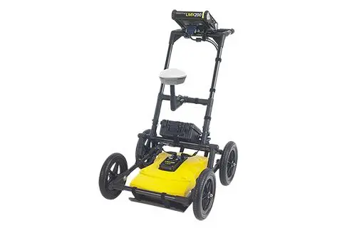
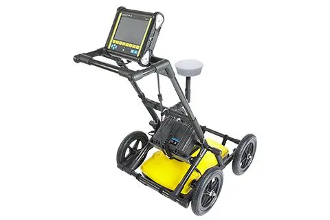
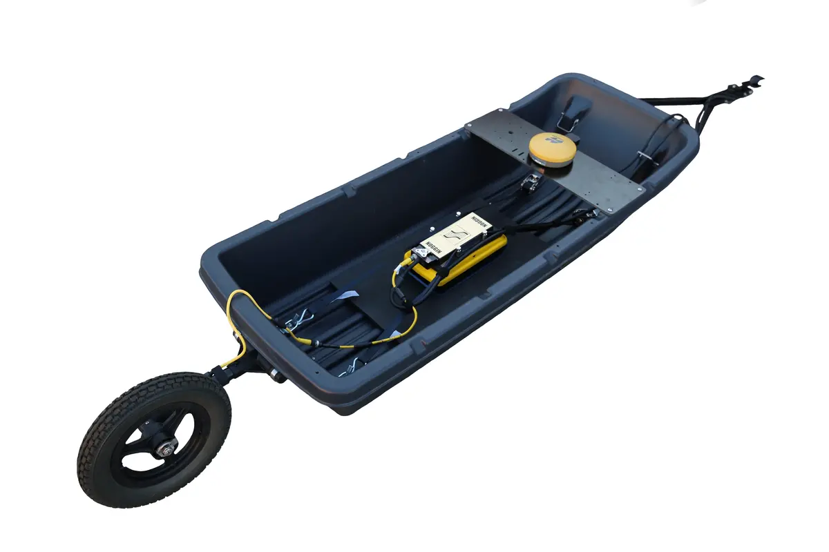
Sensors & Software’s SG for GPR accessory bundles provide an out-of-the-box
solution to integrate high-accuracy GNSS positioning into your GPR data. Every
SG package includes a pre-configured Juniper Geode™ with connectivity, setup,
and battery management all taken care of at the system level, making it easy to
incorporate precise positioning into your GPR workflow.
| SG Package includes | Optional RTK Upgrade adds |
|
| Features | Multi-frequency (L1, L2, L5) • Multi-constellation including GPS, GLONASS, BeiDou, GALILEO • Galileo High Accuracy Service (GALHAS) support |
Multi-frequency (L1, L2, L5) • Multi-constellation including GPS, GLONASS, BeiDou, GALILEO • Galileo High Accuracy Service (GALHAS) support |
| Accuracy | 30cm RMS1 20cm (with GALHAS)1 |
1cm RMS1 with RTK correction service2 |
| Correction services |
Local SBAS correction (free) • WAAS in North America • EGNOS in Europe • GAGAN for South Asia • MSAS for East Asia |
• Ground-based, NTRIP cellular correction services, available free of charge in some areas, or through paid subscriptions2 • The satellite-based correction service, ATLAS®, provided by Juniper® Systems2 • For a list of Geodecompatible RTK correction services available in your region, visit junipersys.com |
| Configuration | n Pre-configured, ready to use out of the box |
NTRIP or satellite correction must be configured in Geode App (instructions provided) |
| Custom cable | Noise-suppressing power cable: • Removes interference with GPR signals • Powers the GNSS directly from the GPR battery |
Noise-suppressing power cable: • Removes interference with GPR signals • Powers the GNSS directly from the GPR battery |
| Data integration | n GNSS positioning data is integrated directly into GPR data for powerful locating and mapping advantages in the field and post-processing. |
n GNSS positioning data is integrated directly into GPR data for powerful locating and mapping advantages in the field and post-processing. |
| System Compatibility |
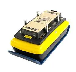
LMX® , NOGGIN® , pulseEKKO® , SPIDAR® |
LMX® , NOGGIN® , pulseEKKO® , SPIDAR® |
Benefits of High Accuracy GNSS
Enhanced in-field GPR visualization
- Easily track linear targets.
- See MapView images with geo-referenced depth
slices, survey path, field interpretations & flags.

Map your results with automatic GPR outputs

Explore more from our collection.
Reviews
There are no reviews yet.